Showing posts with label National Forest. Show all posts

Tuesday, August 5, 2014

Lost Forty

CHIPPEWA NATIONAL FOREST
DEER RIVER - MINNESOTA

The Lost Forty is a must see for anyone living anywhere near Minnesota. The Lost Forty offers close up views of the oldest and biggest pines in Minnesota and probably for miles around. Deep in the heart of the Chippewa National Forest is an area that was missed by loggers as a surveying crew mistakenly plotted this area underwater. Granted it was November and they were probably cold, tired, and miserable. But then if you spend too much time outdoors up north in Minnesota that time of the year things like that will
happen. The Superior National Forest is an area which garners much more star power in the hearts of visitors but I guarantee you if the Lost Forty was located off of Lake Superior's North Shore Drive this would be by far the most visited site in Minnesota. A north shore Lost Forty visitor center would dwarf the Gooseberry Falls visitor center which exists now. But then thats all speculation as it doesnt reside anywhere near a populace or well driven road. In actuality you need to do some driving to get here and its in an isolated area of the forest also. The good news is the roads are in great condition with little to no washboard.


The Lost Forty is actually 144 acres. There are two hiking loops with the closest loop containing almost all of the old growth pines. In the old growth area you will find the biggest trees and the oldest. They say the oldest trees in here are 300-400 years old. 


For those who are not interested in long day hike this trail wont make you work too hard to get the prize. The trail starts right next to the road and has plenty of signs to read along the way.

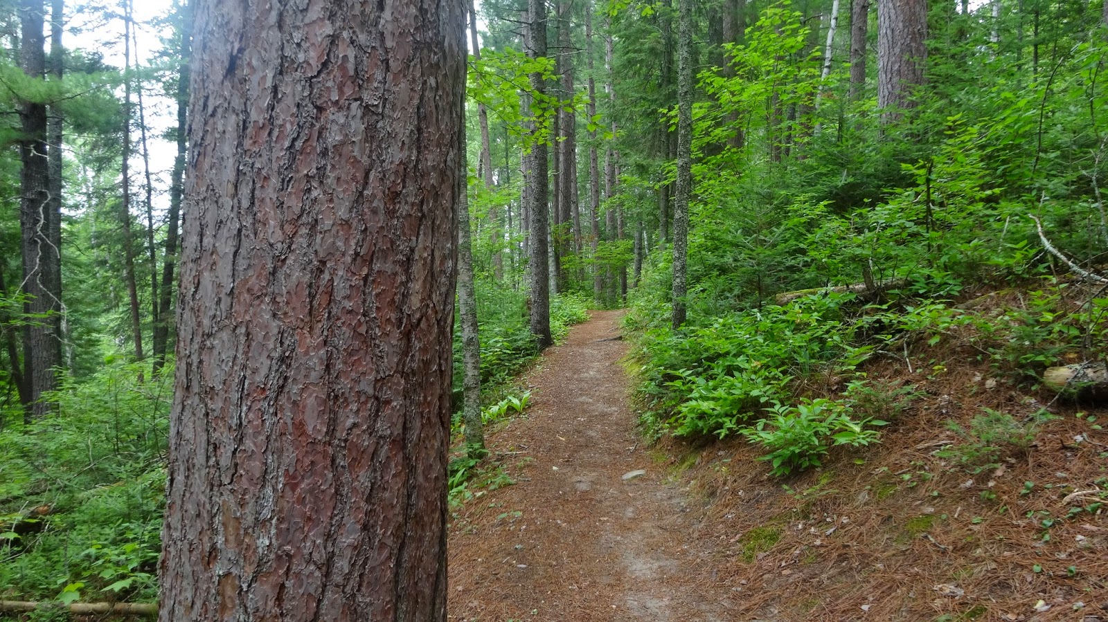
The trail was quiet when we walked thru. There were a couple of cars in the parking lot when we showed up but they moved on rather quickly. The trail is a carpet of pine covered needles.

Not far into the trail you come across your first large pine. The bark on these creatures are amazing. Look at how thick it is! I'm not sure I could pound a nail into it if I tried. I'm actually sort of glad that this place is so isolated so as to keep vandals away.

This was about the biggest tree on the trail and we tried to ring our arms around it. It took three people and they just barely were able to touch!

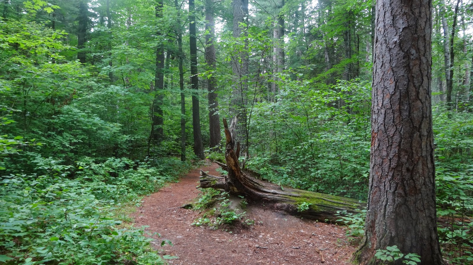
Walking along the trail you'll find a big pine sitting right next to the trail. They truly are an amazing sight. I had seen pictures of this area but had not thought I would be impressed. These pictures do no justice to what you will see.

I found myself gazing thru the woods looking for other big ones. There are plenty of smaller pines that as far younger than the time that the loggers came thru this area over a hundred years ago which tells me there has been a lot of changes in this forest and always will be.

There are dead and down trees along the way too. Some of them rather big. Not as big as the ones standing.

We hiked thru on a Saturday. The weather was decent and plesant enough. I was surprised how few people made their way onto the trail. For almost our entire time here we had the trail to ourselves and we spent almost two hours here.

About the time you wonder if there are anymore really big pines you come face to face with one that dazzles and awes. I've seen some pretty big oaks but nothing like this in terms of a pine. To really get an idea as to how big these are you need to stand next to them.

The woods are filled with newer pines as well. These all have to be sixty years old or less. I am gauging that on some other stumps and downed trees we had seen and counted the rings on.

There was plenty of growth under the canopy. This is not like out west where we will be able to see thru the trees with nothing to block our sight. I enjoy each in their own right.

I found myself hanging behind and listened to the whisper as a gentle breeze periodically moved its way thru. There are a few small hills but generally the trail is pretty flat as the whole area in the Chippewa is relatively flat.

I cant express the amazing solitude one can get out here. I wondered what wildlife makes its home in here. Here is one of the few descents on the trail. Nothing too strenuous but a change in pace to keep things interesting.

So many pines along the path. I decided to include as many pictures as possible here just because I can.

Here was a big one laying next to the trail. Was a good place to stop and get up and walk.

This sign says that fire will travel thru these forests every 30-50 years and its good for the overall health of the forest. That heavy bark on those trees will be resistant to those flames. Some will show signs of there being a fire however.

This tree was able to withstand a fire and has left its mark of survival. This V is the sign that the fire came from the other side of the tree.

I wonder how many other trees I have passed in the woods that I have mistakenly took as being damage from people or critters. This tree is 100% alive and still growing!

If you hike the entire far loop and get to the end you are rewarded with views of Moose Brook.

The summer of 1967 was the summer of love. 2014 is mightily turning out to be the summer of bugs. There is a bench here and had it not been for the extreme presence of deer flies, mosquitoes, and black flies we would not have moved on so quickly. Before hitting the trail we lathered up heavily with bug spray too.

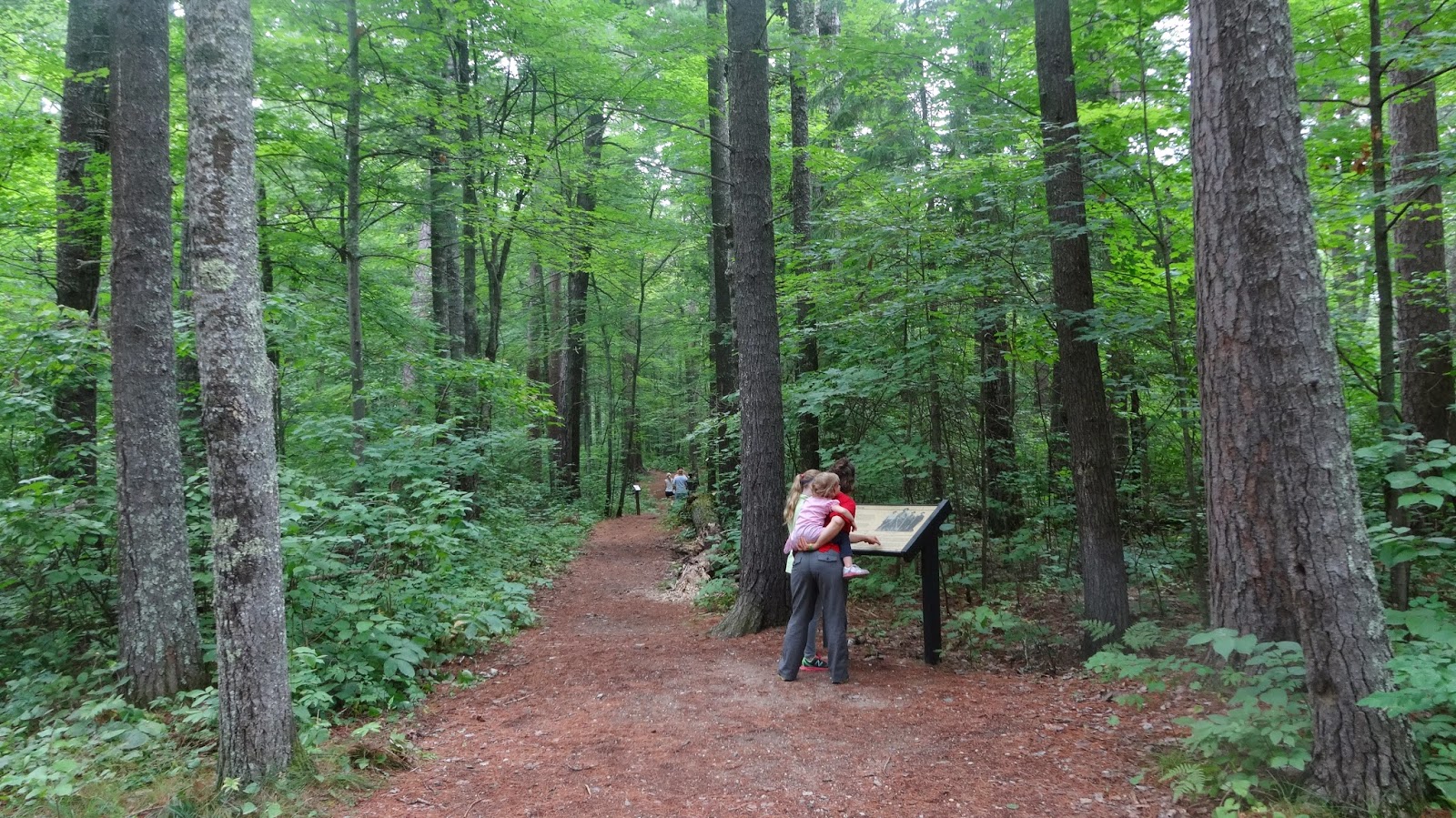
This is the parking area when we arrived. There was one other car and these people did not stay long. They were in and out rather quickly. You can actually see them ahead on the trail in the third picture. We heard them for a  few minutes and then they were gone. They probably only took the short trail as it takes maybe 5-10 minutes to walk thru that part of the trail unless you are like us and make many stops to take in the experience.

If you do take a long time there is a fancy toilet in the parking area. It was clean and smelled fantastic. Fantastic for a vault toilet in the woods. It is cleaned regularly otherwise it would be a mess. Be sure to put this on your itinerary if you live anywhere in Minnesota. If you live or cabin up north in Minnesota you have no excuse not to have been here. This was one of those places I thought would disappoint but that was far from what happened. I am going back and hope to do so soon.

Thursday, June 19, 2014

Guanella Pass Campground

GUANELLA PASS CAMPGROUND
GEORGETOWN - COLORADO

When camping "out west' and picking a campground I have a list of things that I am looking for: Elevation, Pine Trees, Creeks/Streams/Rivers and spacious sites. At Guanella Pass I found everything I was looking for. When picking a campground these days its very easy to do lots of research at home as you can find a wealth of information online. It's amazing what is available to us these days. All of my research told me I was going to have an amazing setup and this campground did not disappoint.

Driving up the Guanella Pass road is mountain driving at its best. The drive up from Georgetown is steep with many switchbacks. The road is rather narrow however pulling my 25 foot trailer I had no issues maneuvering my way thru all those turns. Climbing higher and higher my eyes glanced between the road and my GPS. With every minute that passed my elevation climbed higher and higher until I finally saw the campground sign ahead.

At 10,900 Guanella Pass is Colorado mountain camping at its best. My experience here would be limited to one night so I would have to squeeze every minute out of this visit. I cant remember what the final number for my GPS was but I do believe that it was not 10,900 exactly. But then the campground is hilly throughout that your elevation will change from site to site. The campground resides on both sides of the road. I camped on the east side and that is where all the reservable sites are as well as the hike in tent area. This picture is taken from the highway looking north and what you see is the camp sites west of the road. In most campgrounds camping so close to the road would bring lots of noise from car traffic. Not on this visit for me. I was camping on a Thursday night and it was early June. I dont know the schedule of things for the rest of the summer but on this night the road was very quiet. Our site was right on the river too so hearing anything from the road was downright difficult to impossible.

What you'll notice when camping at Guanella is just how high the peaks are around you. When you take in and realize you are camping just shy of 11,000 feet the sheer size of the peaks around you settles in. I've done lots of camping in the 7,500 to 8,500 range and when you have peaks this close and high so near they are usually under 10,000ft. These were much higher than that. You'll notice that there isnt a huge canopy of trees over you either in this area. Most campsites were that way and for me that was okay because the one thing I wanted to see around me were the peaks.

This loop of the campground is looking southward towards the pass. You'll notice the snow on the peaks. There was actually snow in the campground on our visit. Not out in the open but deep inside the campsites, usually in the rear, and under the cover of trees. The snow melt off continued on during the day and provided a nice run off of water that flowed over and next to the road. Our night there the overnight low dropped to 30 degrees and provided a hard freeze as it got cold early. The run off froze solid and was running water again before we left around noon. There is so much sunshine and when you are this high up the power of that sun is amazing.

The campground curls around in loops. You can see in this picture our camper which is partially hiddden. The picnic table and fire ring are part of another site that you cant actually see from the site I stayed in. Mixing the sound of the creek and the elevation differences of each site you never feel like your neighbors press in on you which works great for those looking for some isolation.

The campsites were well taken care of and very clean. The campground host for this site had not arrived yet for the season as they were having transmission problems with their vehicle. The man I talked to told me that they would be watching this campground until they arrived. This area here is right next to the creek in the rear of the picture. Just the picture of perfection in my book when it comes to having a site so close to the creek.

Here is another view of the creek, picnic table and fire ring. My next visit to Colorado will include a stop here and it will be for more than one night!

This picture is taken from the rear of my campsite and heading in towards the hike in tent sites. The hike in sites are not much of a hike in. They are all accessible with a minimal walk. No carts or backpacking necessary.
As you walk up to the tent in sites these are the posts letting you know which campsite is which. Notice the reservation cards on each pole. These sites are busy and used a lot. If you could read the posts you'd see that they would all be full that night as it was Friday.

Another look down into one of the tent sites. Beautiful views of the creek again. If you dont want to tent in the campground another option available is to park along the road up from Georgetown and disperse camp. This forest takes their dispersed camping seriously as they have paved little pull outs all the way up to the pass for cars to park on. Campers then carry their gear in a short distance and pitch their tent. There are no toilets, running water, or garbage but the camping (with many sites along the creek) is as good as it gets if you like it quiet.

Yet another view of the campground and a campsite. A cleared out area for a picnic table and fire ring. Beautiful views of the mountains and notice how dense the tree cover is around you.

This is another campsite on the east side of the road and is more of a camper site than a tenting one. Being on the east side it is reservable.
The site where we stayed. Picnic table and fire ring in the rear. My 25 foot trailer and van fit nicely onto the pad. The creek runs adjacent to this just to the left.

Notice the snow in the rear of this campsite. The temperatures were very warm during the day and I can bet that snow was gone in a short few days ahead at most.

This campsite is also on the east side of the road and therefore reservable. I dont have many pictures of the west side and thats mainl due to time constraints. This site was away from the creek however you could easily hear the creek standing here.

This is the campground looking south towards the pass. The pass is a short drive to the top and provides plenty of hiking opportunities including a hike to the top of Mt Bierstadt which tops out just over 14,000. For those wanting to take their trailer over the pass and down the other side there are no restrictions doing so. There actually restrictions taking vehicles or combination of vehicles over 35 ft over Independence Pass near the Aspen / Twin Lakes area. Word of warning to those who do so here the road gets to be a mess of washboard as you get closer to Grant. I know they are in the middle of paving gravel and repaving areas at present and hope to have that part of the road completely topped over this year or the next. For me though this season the going was slow when I left here and drove down to Grant.

Friday, July 19, 2013

Middle Fork Campground

BIGHORN NATIONAL FOREST
BUFFALO - WYOMING

Just a short drive up the Cloud Peak Skyway from Buffalo WYO is Middle Fork Campground in the Bighorn National Forest. This campground is small, quiet and one of my favorites. During the summer if you absolutely have to stay here be sure to make reservations (Reserve America or Recreation.gov. We spent four nights here on this trip and made our reservations six months back to the day to ensure we got the site we wanted. This is the sort of campground where you see reservations for an entire two weeks which is the maximum stay.

Thursday, July 1, 2010